Vision Dixie Scenarios
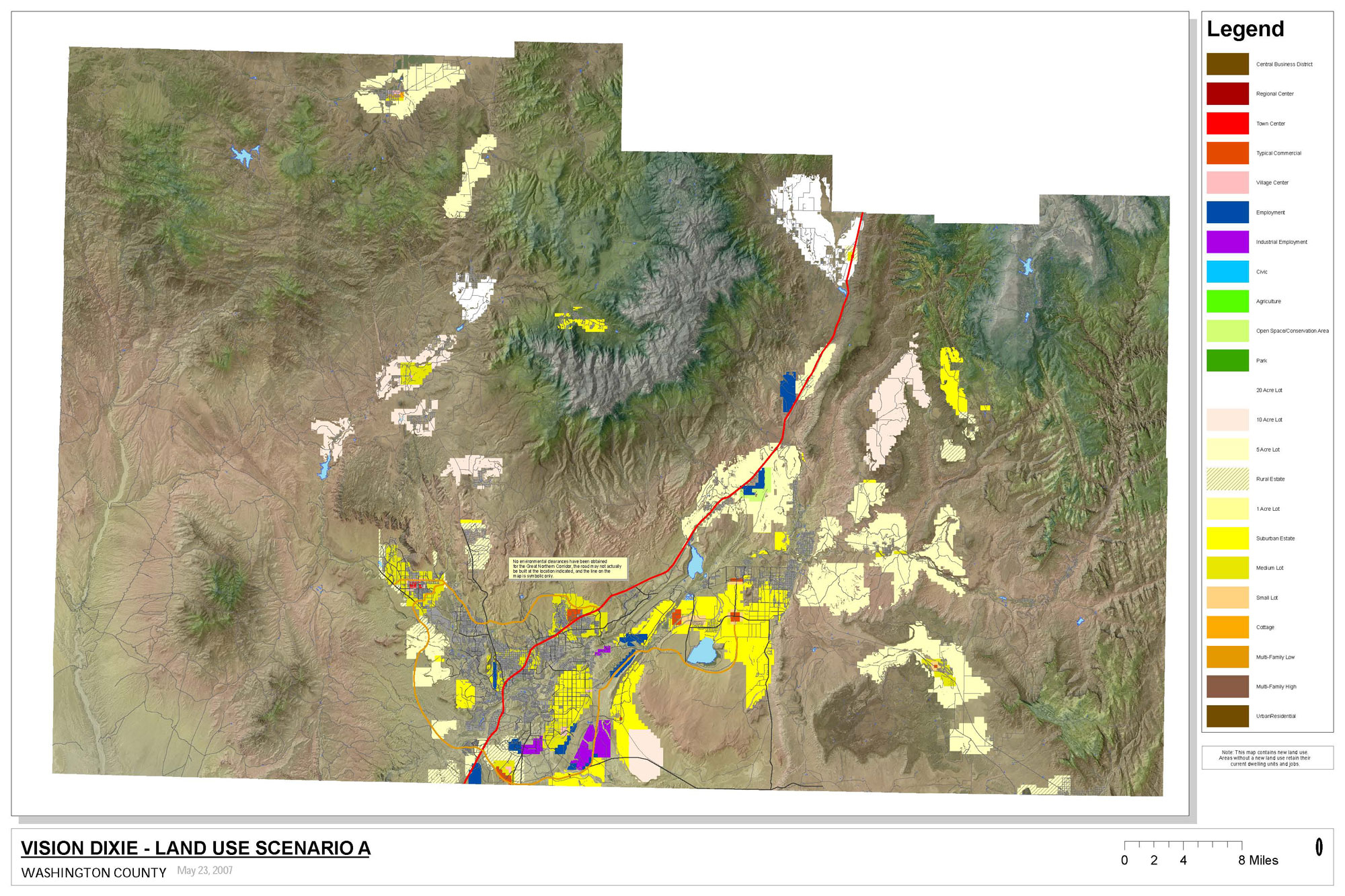
Scenario A
Almost all residential growth occurs beyond the edge of existing cities in separated groupings of larger lot single-family homes. Employment growth is kept away from residential areas, focusing in major business areas. People shop in big box centers, such as Target or Home Depot, and enclosed malls. To accommodate this pattern of growth, some Bureau of Land Management (BLM) lands that are separated from existing cities are converted to private ownership.
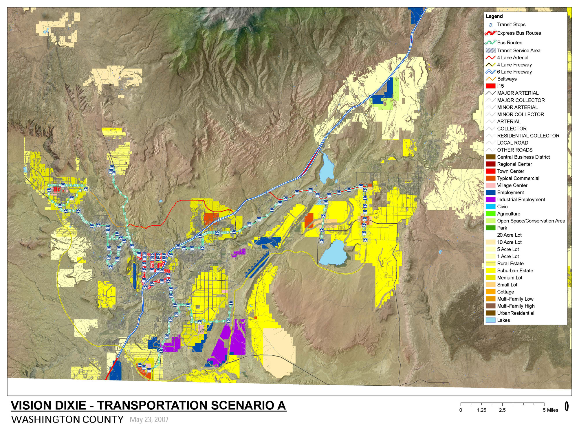
The St. George metro area develops a ring of new freeways to serve growth. Sun Tran extends bus service further into neighboring cities and buses operate about as frequently as they do in 2007.
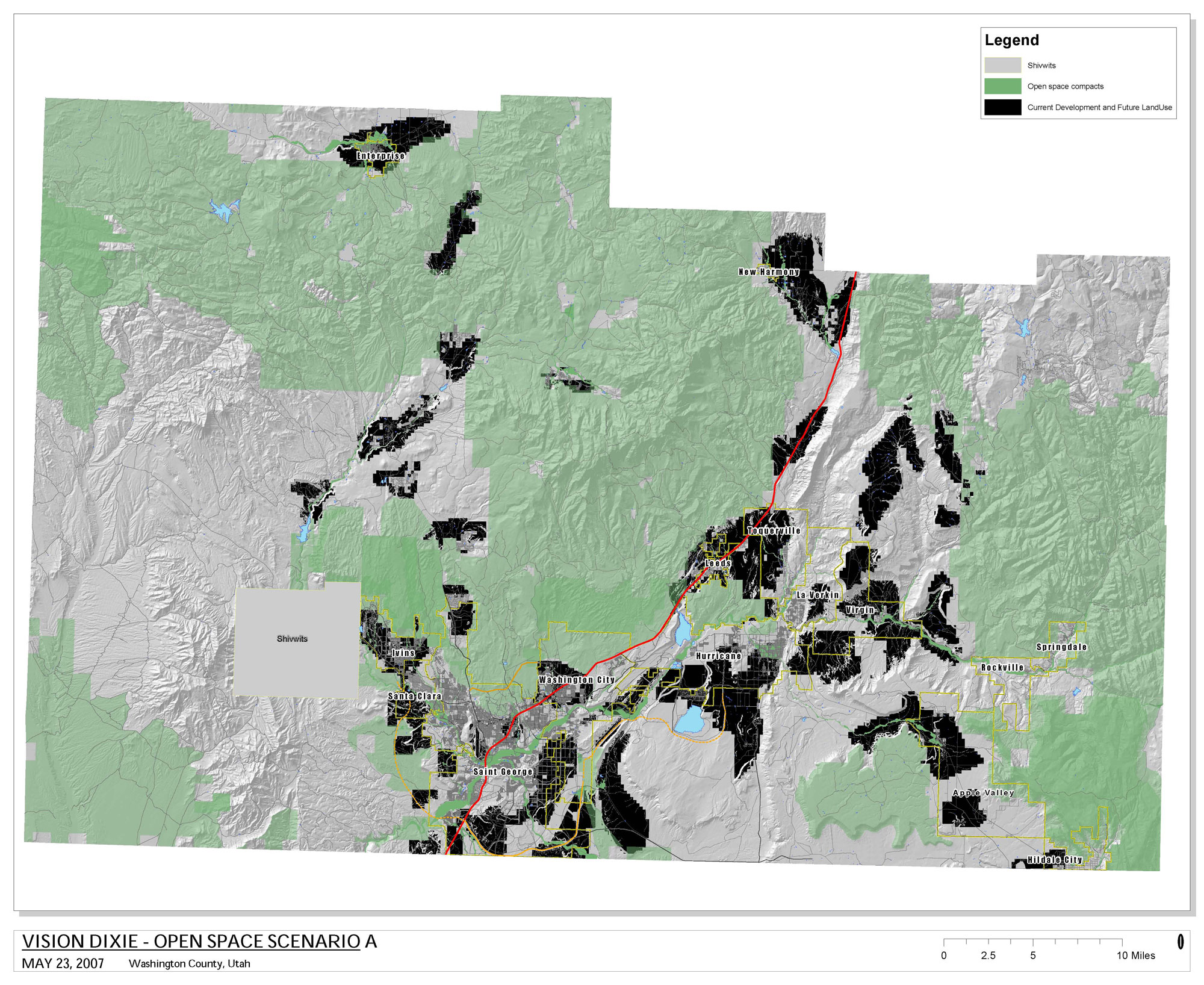
Floodplains and designated critical habitats are conserved for recreation or open space. Development sometimes occurs on steeper slopes, ridgetops, and on animal habitat.
Scenario A Maps
Scenario A Map (jpg/700 KB)
Scenario A Map (PDF/21 MB)
Scenario A Open Space (jpg/700 KB)
Scenario A Open Space (PDF/22 MB)
Scenario A Transportation (jpg/850 KB)
Scenario A Transportation (PDF/25 MB)
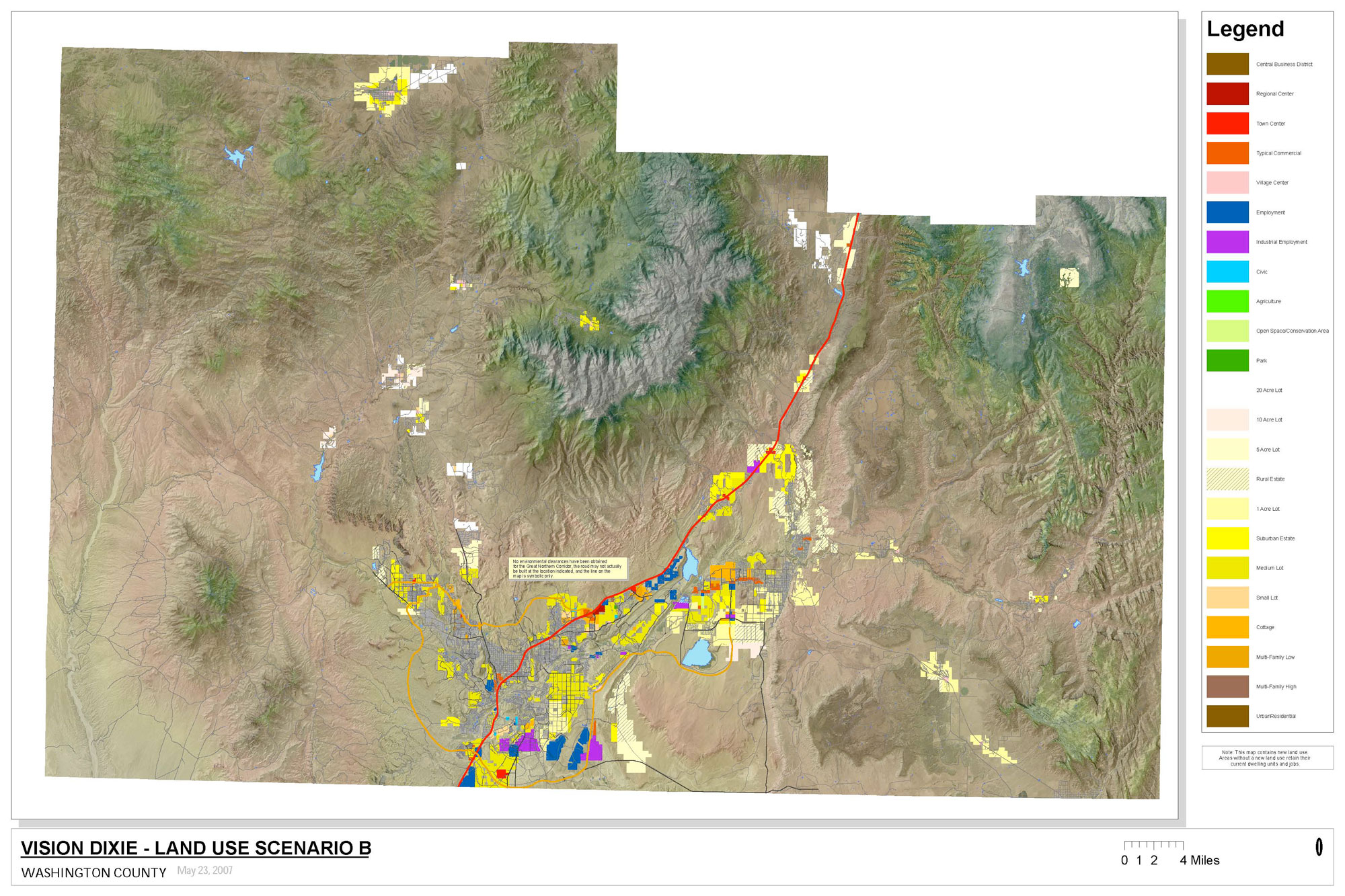
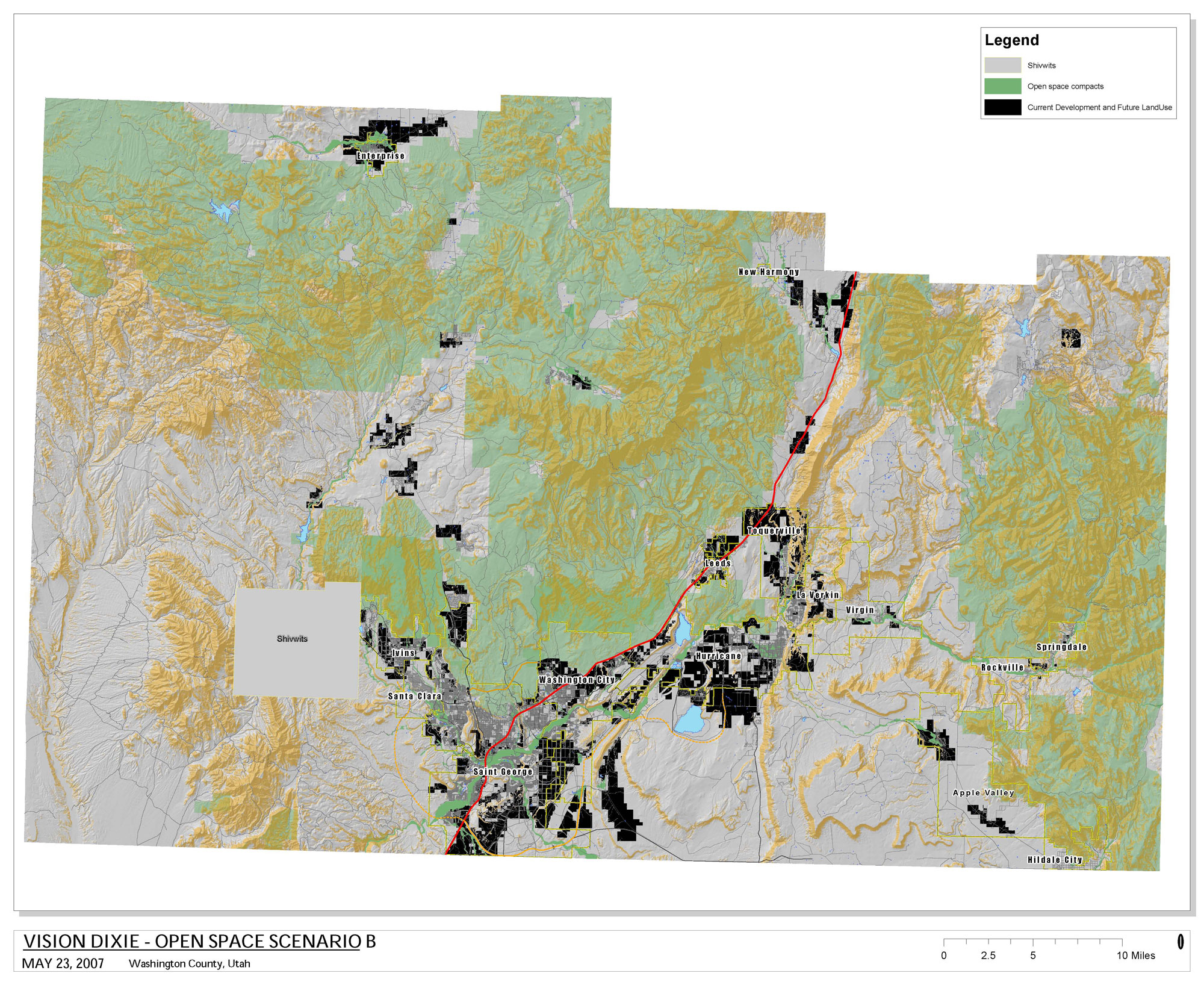
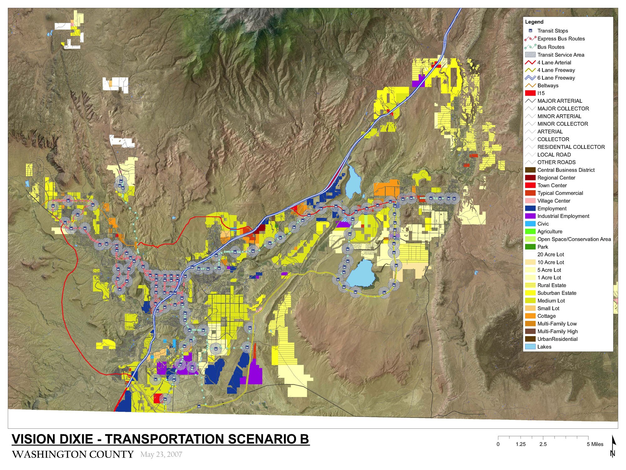
Scenario B
Most residential growth occurs beyond the edge of cities in single-family subdivisions, with some lot sizes smaller than recent growth. Employment growth is mostly kept away from residential areas. Most people shop in big box centers and enclosed malls. Some Main Street type shopping occurs. To accommodate this pattern of growth, some BLM lands in areas that cities currently plan to annex are converted to private ownership.
The St. George metro area develops a ring road composed of arterials and some freeways. Sun Tran extends bus service further into neighboring cities, and buses operate more frequently than in 2007.
Steeper slopes, floodplains, and designated critical habitats are conserved for recreation or open space. Development sometimes occurs on ridgetops, and on animal habitat.
Scenario B Maps
Scenario B Map (jpg/600 KB)
Scenario B Map (PDF/21 MB)
Scenario B Open Space (jpg/900 KB)
Scenario B Open Space (PDF/24 MB)
Scenario B Transportation (jpg/900 KB)
Scenario B Transportation (PDF/6 MB)
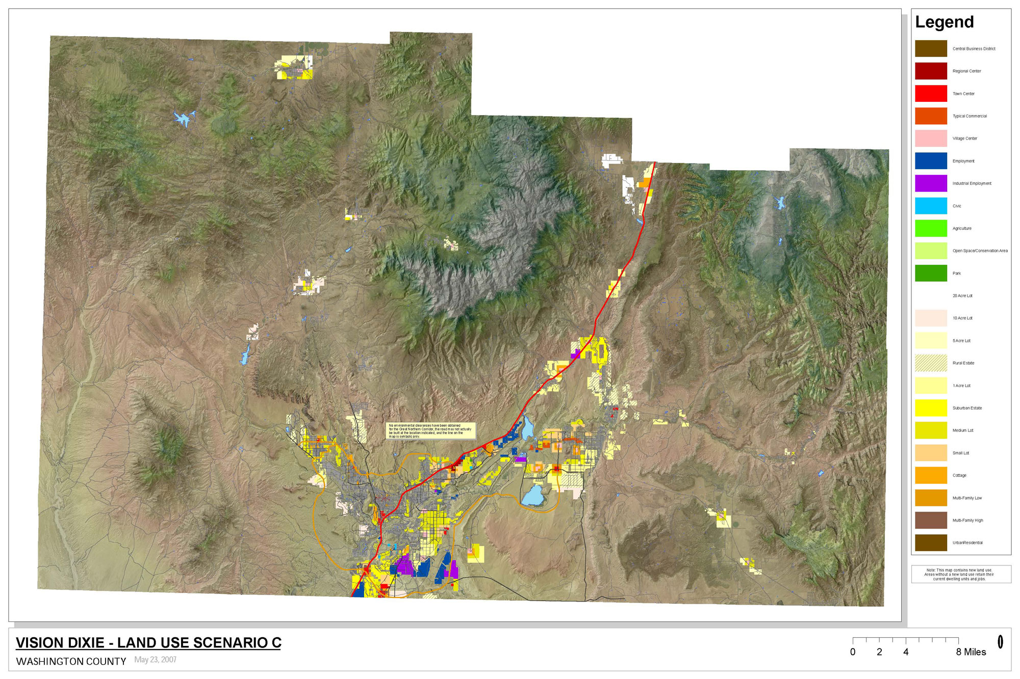
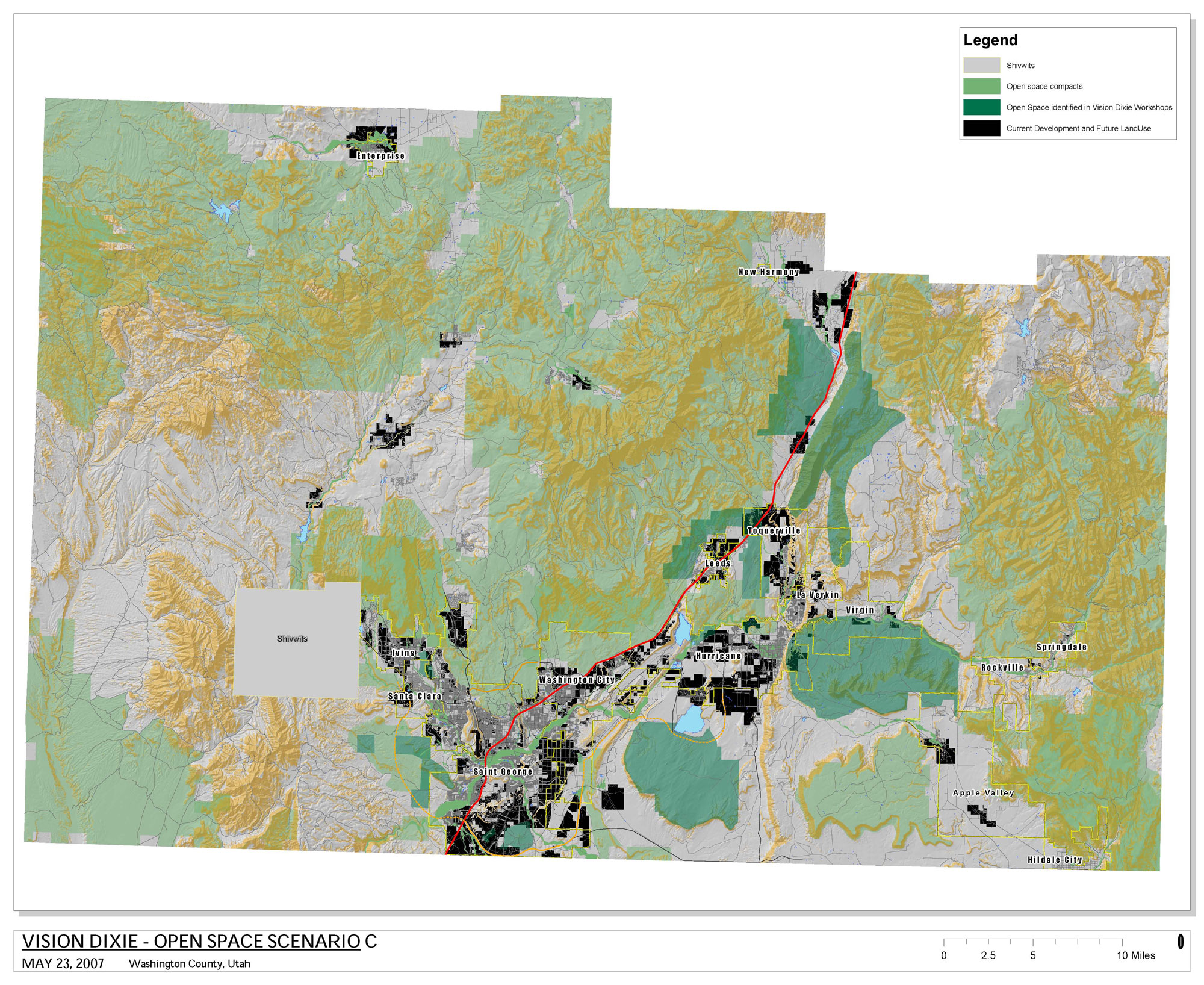
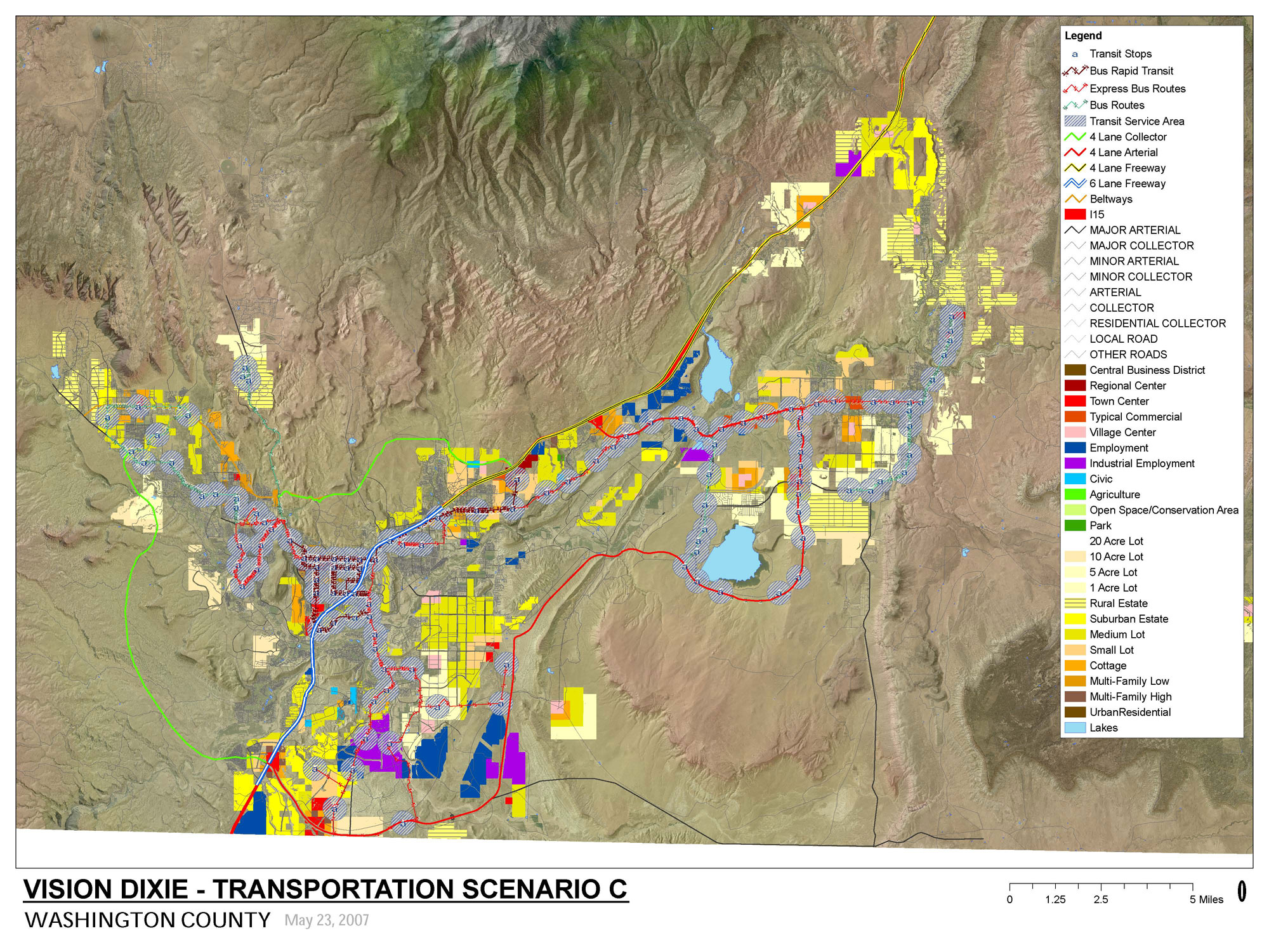
Scenario C
Most growth occurs adjacent to the edge of cities. This growth takes the form of villages where single family housing surrounds a center that mixes offices, shopping, townhouses and condos. Growth also fills in vacant developable land within cities. To accommodate this pattern of growth, some BLM lands in areas within existing city limits are converted to private ownership.
The St. George metro area develops a ring road composed of arterials and in-town boulevards. A rapid busway, essentially light rail on rubber tires, is introduced to the St. George metro area on Sunset Boulevard and SR9. Sun Tran also extends bus service further into neighboring cities, and buses operate much more frequently than they do in 2007.
Ridgetops, river corridors, steeper slopes, floodplains, and designated critical habitats are conserved for recreation or open space.
Scenario C Maps
Scenario C Map (jpg/600 KB)
Scenario C Map (PDF/21 MB)
Scenario C Open Space (jpg/900 KB)
Scenario C Open Space (PDF/24 MB)
Scenario C Transportation (jpg/900 KB)
Scenario C Transportation (PDF/35 MB)
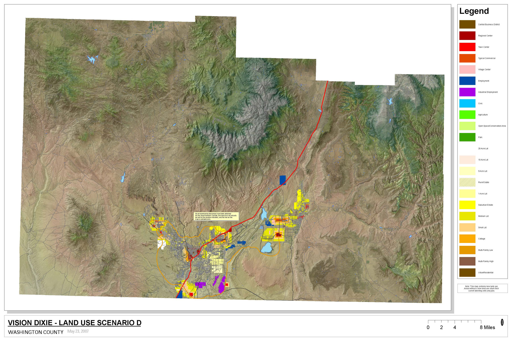
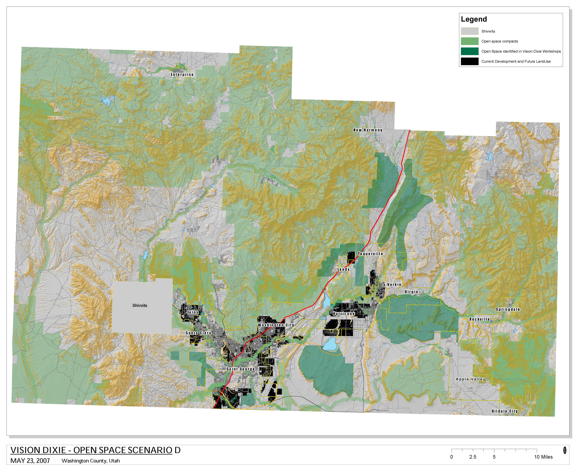
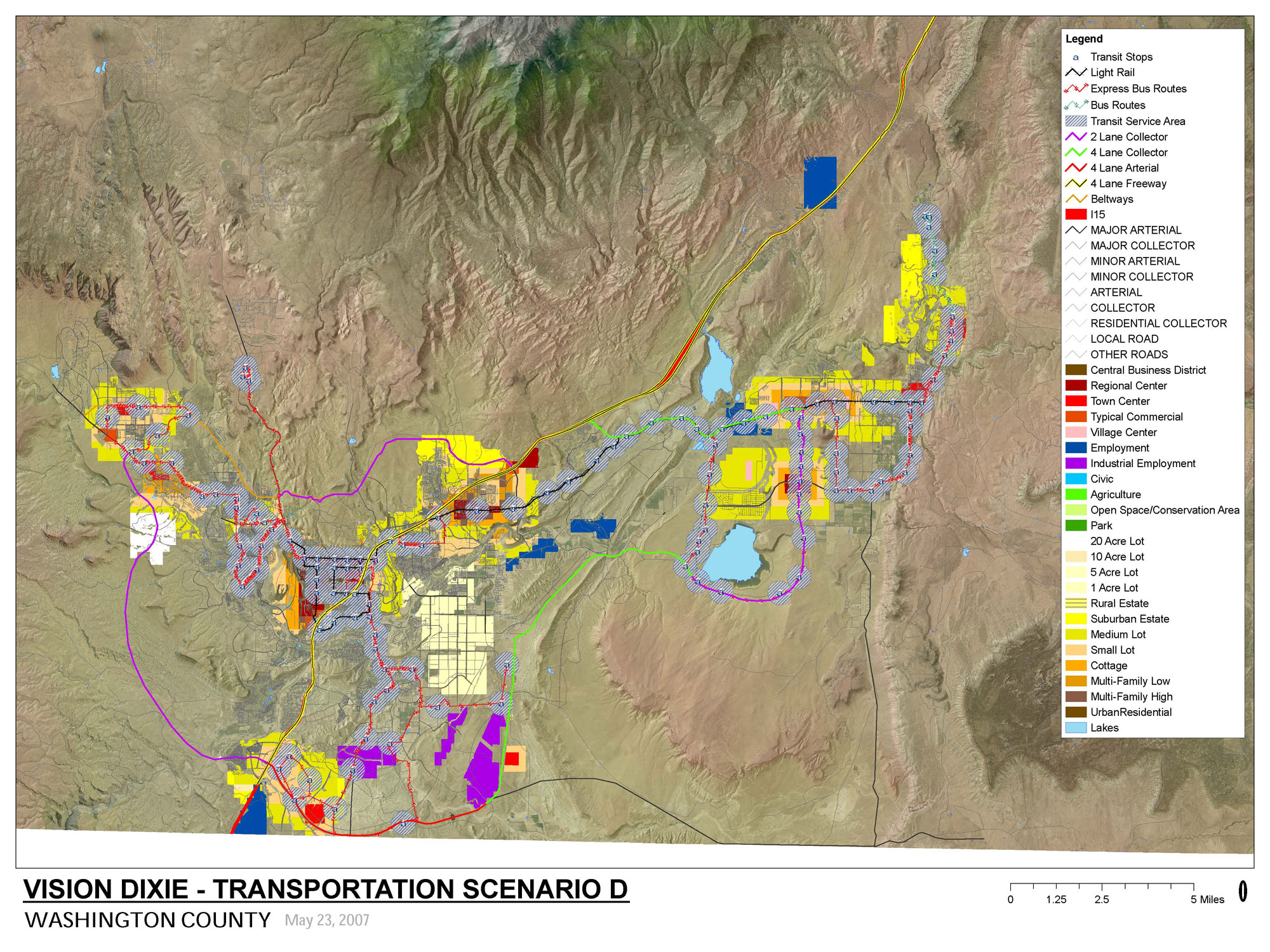
Scenario D
The St. George metro area develops a ring road composed of in-town boulevards and minor arterials. This growth places a mix of jobs, shopping, townhouses, and condos at the center of cities, with single family housing nearby. To accommodate this pattern of growth, few, if any, BLM lands are converted to private ownership.
A new major city street links the east and west sides of the St. George Metro area by connecting south of St. George. Light rail is introduced to the St. George metro area. Sun Tran also extends bus service much further into neighboring cities and buses operate much more frequently than they do in 2007.
Ridgetops, river corridors, steeper slopes, floodplains, and designated critical habitats as well as areas set aside to link these features together are conserved for recreation or open space.
Scenario B Maps
Scenario D Map (jpg/600 KB)
Scenario D Map (PDF/20 MB)
Scenario D Open Space (jpg/900 KB)
Scenario D Open Space (PDF/24 MB)
Scenario D Transportation (jpg/900 KB)
Scenario D Transportation (PDF/35 MB)
How the Scenarios Compare


![]()
![]()
![]()


After you have reviewed the scenario information below, please take a few minutes to take the Vision Dixie Scenario Questionnaire.